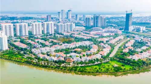
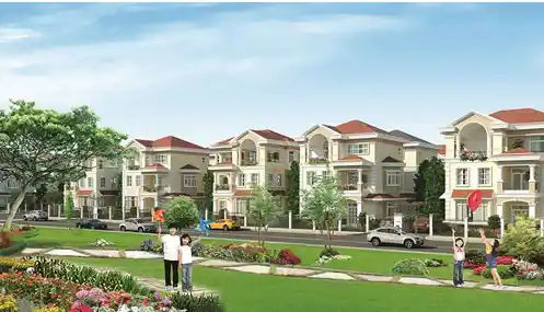
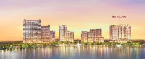
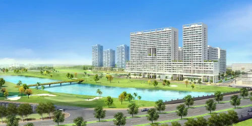
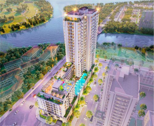
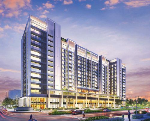
Phú Hưng Khang is a 405ha model ecological urban development complex being developed by Phu Mỹ Hưng Development Corporation in Thịnh Minh Commune, Phú Thọ Province. It is divided into 4 functional zones, from Zone 1 to Zone 4, integrating housing, tourism, resorts and high-quality healthcare within a complete ecosystem adjacent to 300ha Đầm Bài Lake. In particular, the official 1:2000-scale masterplan published on 22/05/2026 confirms Phú Hưng Khang as a leading strategic project in Phu Mỹ Hưng’s northern expansion journey, carrying the tagline “Timeless identity” and expressing a vision of building a sustainable, long-term urban area for the north-western area of the Capital Region.
Phú Hưng Khang’s model eco-urban area has been planned around 3 core ecological criteria: preserving the water surface of Đầm Bài Lake, establishing a truly large-scale green belt of planted forest in Zone 3, and integrating multifunctional green living across 4 organically connected precincts. Furthermore, this model does more than simply create high-quality living spaces; it also develops a multi-layered service ecosystem ranging from high-end healthcare to resort accommodation and retail, comprehensively meeting the needs of financially strong customer groups in the northern market.
Phu My Hung Development Corporation has the necessary reputation to develop Phú Hưng Khang, having successfully built the 409ha Phú Mỹ Hưng urban area in Ho Chi Minh City over more than 30 years, while also receiving a financial guarantee commitment of VND 1,700 billion from IFC (World Bank Group) for the project. At the same time, Phú Thọ Province issued Notice No. 363/TB-UBND dated 05/06/2026, placing Phú Hưng Khang in the priority “green lane” mechanism, confirming the highest level of policy support from the local authorities and the target of commencing construction in November 2026.
In terms of infrastructure connectivity, Phú Hưng Khang is directly adjacent to the completed CT Expressway to the south-east and lies within the area influenced by Ring Road 5 under the Capital Region Framework Network, approximately 60km from central Hanoi, with a journey time of 45 to 60 minutes. The following article analyses each aspect of Phú Hưng Khang in detail, giving northern investors a sufficient basis for evaluation and accurate decision-making while the project completes its legal procedures.
Project Overview
What is Phú Hưng Khang? An overview of the eco-urban development in Thinh Minh Commune, Phú Thọ
Phú Hưng Khang is a 405-ha model eco-urban cluster developed by Phu My Hung Development Corporation in Thinh Minh Commune, Phú Thọ Province. It comprises 4 functional subdivisions beside the 300-ha Dam Bai Lake and is planned at a scale of 1:2000.
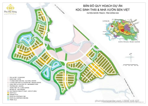
To gain a clearer understanding of Phú Hưng Khang, 3 constituent factors must be considered together: its geographical location and adjoining boundaries, the product structure of its 4 subdivisions, and the developer’s “Timeless Identity” development philosophy. The complete official planning map, published on 22/05/2026 at a scale of 1:2000, details the planning boundary, subdivision boundaries and the setback boundary protecting Dam Bai Lake. It is the most important technical and legal foundation for the entire implementation process, from completing procedures through to construction commencement and launch.
Where is Phú Hưng Khang located and what does it border?
Phú Hưng Khang is located in Thinh Minh Commune, Phú Thọ Province. It borders the 300-ha Dam Bai Lake at its core, DT445 Provincial Road to the north, Quang Tien – Thinh Minh Road to the east and the CT Expressway to the south-east.
More specifically, Phú Hưng Khang’s 4 strategic geographical boundaries are identified on the planning map as follows. To the north, it borders DT445 Provincial Road, a regional transport route connecting communes in Phú Thọ, enabling multidirectional movement for residents and goods and service vehicles. To the east and north-east, it borders Quang Tien – Thinh Minh Road, a local artery running along the eastern edge of Zone 4 and facilitating flexible daily travel within the commune and surrounding areas. To the south-east, the most important point for inter-regional connectivity, the development directly borders the CT Expressway, marked “ĐI CAO TỐC CT” on the 1:2000 planning map, providing a key transport gateway to Hanoi.
In terms of the landscape setting, the 300-ha Dam Bai Lake, which embraces the core of the entire development, is a unique natural feature that no artificial urban development in the Capital Region can replicate. Combined with the natural mountainous terrain and nearby golf courses, Thinh Minh Commune offers an ideal ecological setting for creating a genuine eco-urban development in accordance with international standards, rather than merely applying the “eco” label through a few decorative green spaces.
What types of property and subdivisions does Phú Hưng Khang include?
Phú Hưng Khang comprises 4 main subdivisions based on their functions: Zone 1 (low-rise housing, including villas, terraced houses and social housing), Zone 2 (housing combined with public healthcare and cultural services), Zone 3 (planted forest greenery and water areas) and Zone 4 (resort accommodation, hotels and commercial facilities).
Below is a detailed analysis of each subdivision in the master plan, helping investors identify the right property type and subdivision for their objectives:
Zone 1 is located in the south-east and directly borders the CT Expressway. This is the main low-rise residential subdivision, comprising detached villas, terraced houses and social housing, serving a large permanent resident community. Urban greenery marked (CX) is distributed throughout Zone 1, according to the map notes, ensuring the required greenery ratio under urban planning standards.
Zone 2 occupies the south-west and combines low-rise housing with public service facilities, including healthcare, cultural and internal commercial facilities. Zone 2 serves as the essential-services axis for both the internal community and surrounding residents, creating a complete service ecosystem for the urban development.
Zone 3 extends towards the north and north-west and is characterised by urban greenery, large-scale planted forest greenery marked (EXT) and water areas marked (MN). Zone 3 is the ecological “lungs” of the entire development, creating a microclimate protection belt and ensuring air quality for the whole residential community even after urbanisation is complete.
Zone 4 is located in the north-east along Quang Tien – Thinh Minh Road. It is a commercial and resort subdivision comprising a high-end resort, hotels and a range of commercial services, targeting tourists and holidaymakers from Hanoi and neighbouring provinces and generating sustainable service revenue for the entire urban ecosystem.
Project Location
Which strategic transport infrastructure routes in the Capital Region Network does Phú Hưng Khang’s location in Phú Thọ connect to?
Phú Hưng Khang connects to 2 strategic infrastructure corridors: the CT Expressway, already established to the south-east (providing immediate connectivity), and Ring Road 5, included in the Capital Region Network master plan (offering future value growth), together with DT445 and the Quang Tiến–Thịnh Minh road within the local area.
To understand the connectivity advantages more clearly, the colour-coding system on the Capital Region Framework Network map (ring roads and radial routes), published on 22/05/2026, must be read correctly. On this map, yellow indicates an existing expressway, purple indicates the existing Ring Road 3, red indicates the unbuilt Ring Road 4, and blue indicates the unbuilt Ring Road 5. This distinction enables investors to accurately assess 2 different layers of value: currently operational connectivity and the potential for improved connectivity in the future—2 factors that have different effects on the property price-growth cycle.
Is Phú Hưng Khang located on Ring Road 5 and the CT Expressway in the Capital Region Network?
Yes. Phú Hưng Khang is directly connected to both the existing CT Expressway (current connectivity) and the unbuilt Ring Road 5 (potential future value growth), creating 2 parallel, complementary layers of transport advantages.
Specifically, regarding the existing CT Expressway (yellow): Phú Hưng Khang directly adjoins this route along its south-eastern boundary, marked “ĐI CAO TỐC CT” on the 1:2000 master plan. This is an existing transport connection, allowing travel from the development to Hanoi in 45 to 60 minutes without depending on future infrastructure. The Nội Bài–Lào Cai Expressway (yellow, existing) is an important north-western radial route, linking Phú Thọ with Hanoi and the entire Nội Bài international airport network.
Regarding the unbuilt Ring Road 5 (blue): Phú Hưng Khang lies within this route’s planned area of influence. Once Ring Road 5 is completed, Phú Hưng Khang’s connection to the outermost ring road of the entire Capital Region will be significantly upgraded, providing an additional long-term boost to property values for investors who enter at an early stage.
How long does it take residents to connect from Phú Hưng Khang to central Hanoi and neighbouring provinces?
The journey from Phú Hưng Khang to central Hanoi takes approximately 45 to 60 minutes via the CT Expressway, covering a distance of 60km. It lies within the “golden zone” of an ecological satellite city: far enough to be completely separate from the pressures of a major urban area, yet close enough to maintain uninterrupted connectivity.
In addition, Phú Hưng Khang’s local and inter-regional connectivity is supported by 2 complementary routes. DT445 to the north is a provincial road connecting to Phú Thọ’s intra-provincial transport network, providing access to Việt Trì city centre and industrial parks in the region without needing to use the expressway. The Quang Tiến–Thịnh Minh road to the east supports flexible daily local travel for residents within the commune and surrounding areas.
Of particular importance from a long-term investment perspective, once Ring Road 5 is completed under the Capital Region Network master plan, Phú Hưng Khang residents will gain an additional outer-ring connection to Thái Nguyên in the north-east and Hải Phòng in the east. This will significantly expand the surrounding economic area and enhance Phú Hưng Khang’s position on the property map of the entire Capital Region.
Project Floor Plans
What ecological planning criteria underpin the Phú Hưng Khang model ecological urban development?
Phú Hưng Khang has 3 core ecological criteria under its planning standards: preserving and making use of the Đầm Bài lake water surface; establishing a genuine planted-forest green system in Zone 3; and integrating interconnected, multifunctional green living across the 4 precincts.
In addition, Phú Hưng Khang’s ecological model reflects the development philosophy that Phú Mỹ Hưng has proven in Ho Chi Minh City over 30 years: rather than separating residential, commercial, healthcare and leisure functions, it integrates them all within a seamless master plan to optimise the quality of life for each resident. The 1:2000 master plan clearly uses 3 distinct ecological symbols: (CX) Urban Greenery, (MN) Water Surface and (EXT) Planted Forest Greenery. This demonstrates that the development’s ecological standards are considerably higher than those of conventional property developments that use only one general greenery symbol. This is an important technical indicator that planning-savvy investors should identify when assessing the true quality of a development marketed as ecological.
What central role does the 300ha Đầm Bài Lake play in the design of Phú Hưng Khang’s ecological urban development?
The 300ha Đầm Bài Lake is the ecological centrepiece of Phú Hưng Khang, performing 3 strategic functions simultaneously: regulating the microclimate across the entire development, providing waterside landscapes for lakeside villas, and establishing the foundation for ecological tourism services in Zone 4.
Specifically, on the 1:2000 master plan, all 4 precincts are arranged around and oriented towards Đầm Bài Lake, affirming the irreplaceable central position of the water area in the overall planning strategy. The lake’s protective setback boundary is shown by a grey line on the map, separating the building plots from the lake edge and creating a continuous lakeside landscape corridor where residents can walk and relax without interruption from buildings.
More importantly, the landscape value of the 300ha lake is a factor that directly enhances long-term property valuations: water-facing views for most villas and adjoining houses in Zone 1 and Zone 2 are among the rarest attributes in the northern market. Combined with the hilly terrain and nearby golf courses, Đầm Bài Lake creates a natural resort ecosystem that cannot be artificially recreated or replicated, representing Phú Hưng Khang’s most sustainable competitive advantage across the entire Capital Region’s ecological urban development segment.
What notable ecological urban amenities does Phú Hưng Khang integrate for residents?
Phú Hưng Khang integrates 4 main amenity groups: diverse housing types (Zones 1 and 2); public healthcare and cultural services (Zone 2); premium commercial resorts (Zone 4); and ecological landscapes comprising planted-forest greenery and water surfaces (Zone 3).
In particular, in line with the strategic direction that the People’s Committee of Phú Thọ Province asked Phú Mỹ Hưng to prioritise at the working meeting on 29/05/2026, the development will attract high-quality healthcare services combined with resort facilities, targeting premium customers interested in preventive health and comprehensive care. This is an uncommon amenity orientation in the northern satellite-city segment, typically found only in large-scale international urban developments.
The table below summarises the amenity system for each precinct, helping investors and owner-occupiers assess the completeness of the development’s ecosystem before making a decision:
| Sub-area | Amenity type according to the map legend | Primary users served |
| Zone 1 | Villas, adjoining houses, social housing, urban greenery (CX) | Permanent residents |
| Zone 2 | Healthcare, cultural and on-site commercial facilities | Residents + surrounding areas |
| Zone 3 | Planted forest (EXT), water surface (MN), ecological buffer | The entire residential community |
| Zone 4 | Resorts, hotels and premium commercial services | Residents + visitors from Hanoi |
Does Phú Mỹ Hưng, the developer, have sufficient credibility and experience to develop a model ecological urban development in Phú Thọ?
Yes. Phú Mỹ Hưng has sufficient credibility and experience to develop Phú Hưng Khang for 3 core reasons: more than 30 years of success at the 409ha Phú Mỹ Hưng Urban Development in Ho Chi Minh City; financial backing of VND 1,700 billion from IFC, part of the World Bank Group; and a special commitment to a “green channel” mechanism from the People’s Committee of Phú Thọ Province.
Specifically, Phu My Hung Development Corporation was established on 19/05/1993 as a joint venture between Phú Mỹ Hưng Asian Holdings (part of CT and D Group, Taiwan) and IPC (Tan Thuan Industrial Promotion Company, representing the People’s Committee of Ho Chi Minh City). This management model combines international urban development experience based on Taiwanese standards with an understanding of Vietnam’s market and policies, creating a sustainable operating foundation maintained for 30 years—something few domestic property joint ventures have achieved. More importantly, General Director Gary Tseng has personally worked with Trần Duy Đông, Chairman of the People’s Committee of Phú Thọ Province, to commit resources and a development roadmap for Phú Hưng Khang, demonstrating the highest level of strategic priority from the group’s senior leadership.
Which urban projects has Phu Mỹ Hưng developed nationwide before Phú Hưng Khang?
Phu Mỹ Hưng developed 2 major urban projects before Phú Hưng Khang: the 409ha Phu Mỹ Hưng urban area in Ho Chi Minh City from 1993 and the 200ha Hồng Hạc City in Bắc Ninh from 2025, building a foundation of experience from south to north.
Let us explore Phu Mỹ Hưng’s strategic development journey to understand the execution capability behind Phú Hưng Khang:
Phu Mỹ Hưng urban area, Ho Chi Minh City (since 1993): From a completely undeveloped 409ha wetland in District 7, Phu Mỹ Hưng has created Vietnam’s leading model urban area, with international schools, hospitals, shopping centres and a stable, multinational resident community. This is 30 years of practical evidence of its ability to turn plans on paper into a functioning urban area—something few Vietnamese developers can claim.
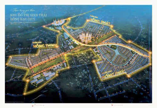
Hồng Hạc City, Bắc Ninh (launched in 2025): The first project to move north, covering 200ha in the north-eastern area of Hanoi, leveraging Bắc Ninh’s connectivity to Ring Road 3 and the expressway network. Hồng Hạc City is a trial in operating an ecological urban model in the northern market, providing foundational experience for Phu Mỹ Hưng to confidently develop Phú Hưng Khang at more than double the scale.
According to the map entitled “Projects developed by Phu Mỹ Hưng” in the official planning materials, the group’s investment portfolio stretches from south to north across the map of Vietnam, demonstrating a methodical nationwide development strategy and a consistent long-term vision through each phase of market expansion.
Which northern expansion project is Phú Hưng Khang, and what is Phu Mỹ Hưng’s strategic vision?
Phú Hưng Khang is Phu Mỹ Hưng’s second northern expansion project, covering 405ha—twice the size of Hồng Hạc City’s 200ha—demonstrating its strategic commitment to building a system of model ecological urban areas in key provinces of the Capital Region.
More importantly, the following 3 strategic signals confirm the sustainability and reliability of this long-term commitment:
The first signal is financial backing from IFC (International Finance Corporation), a member of the World Bank Group, with a commitment to register to purchase VND 1,700 billion in bonds to finance Phú Hưng Khang’s development over a period of 15 to 20 years. IFC requires compliance with the world’s highest Environmental, Social and Governance (ESG) standards before committing to invest; this is an irrefutable guarantee of the project’s quality and sustainability.
The second signal is the strategy of selecting large-scale “clean land”: rather than entering already saturated major urban areas, Phu Mỹ Hưng seeks land banks large enough to build a complete urban ecosystem from the outset. This is precisely how it succeeded in District 7, Ho Chi Minh City, in 1993, and it is a consistent formula in its long-term development philosophy.
The third signal is the special policy commitment from Phú Thọ Province: the provincial People’s Committee has identified Phú Hưng Khang as a modern, civilised model urban area for the province in the future and is applying a special administrative “green channel” mechanism to shorten the entire legal process, with construction scheduled to commence in November 2026.
How does Phú Hưng Khang differ from ecological resort urban areas in the same segment in northern Vietnam, and why should northern investors take an interest at the early stage?
Phú Hưng Khang leads in scale (405ha versus an average of under 100ha for the segment), offers greater developer credibility with 30 years of experience, benefits from the unique, irreplaceable 300ha Đầm Bài Lake landscape and stands out for its special administrative “green channel” mechanism, which shortens legal risks.
However, what truly sets Phú Hưng Khang apart is not any single factor, but the simultaneous convergence of all these factors in one project while its legal framework is still being completed—in other words, an early-entry opportunity at the lowest underlying valuation of the growth cycle. This is the point at which assessing information becomes assessing a real investment opportunity.
How does Phú Hưng Khang differ from ecological resort projects in Hòa Bình and the areas surrounding Hanoi?
Phú Hưng Khang differs from the segment in 3 key respects: its 405ha scale with 4 integrated, multifunctional zones rather than single-function projects of under 100ha; its developer, Phu Mỹ Hưng, with 30 years of experience rather than a local operator; and the Zone 3 planted forest and greenery system, which is genuinely rare in Vietnamese urban planning. While most ecological resort projects in Hòa Bình and the areas surrounding Hanoi are developed by local operators as small-scale, single-function projects (either resorts or individual resort villas), Phú Hưng Khang integrates permanent housing, resorts, premium healthcare and commercial facilities within one cohesive masterplan. The planted forest and greenery system in Zone 3 is a particularly rare feature: it is not decorative greenery, but a genuine planted forest with long-term ecological conservation value, which cannot be recreated once urbanisation is complete and is not possessed by any competitor in the segment.
What specific benefits does Phú Thọ Province’s special legal “green channel” mechanism for Phú Hưng Khang provide to investors?
The “green channel” mechanism under Notice No. 363/TB-UBND dated 05/06/2026 provides 2 specific benefits: reducing legal risks through proactive priority handling by the local authorities and opening up an opportunity to participate in the investment before launch, at the lowest valuation. The Phú Thọ Provincial People’s Committee has set a clear target of commencing construction in November 2026, meaning that the entire legal documentation process will be significantly shortened compared with the usual procedure, which can take many years for a 405ha urban project. Combined with IFC’s long-term financial backing of 15 to 20 years, Phú Hưng Khang is in a legal and financial position rarely seen in the history of large-scale urban development in northern Vietnam, creating an investment opportunity that will be very difficult to replicate in subsequent cycles once the project enters broad launch and its valuation fully reflects its potential.
Find information and book a consultation about the Phú Hưng Khang project at Phú Mỹ Hưng Center
For the most accurate and up-to-date advice on the Phú Hưng Khang project, customers should consult Phú Mỹ Hưng Center (phumyhungcenter.com), a specialist website founded by consultant Kim Thùy, who has many years of practical experience at Phu Mỹ Hưng Development Corporation since 05/2017. Unlike ordinary information aggregation websites, Phú Mỹ Hưng Center provides internal information updated directly from the developer, including the latest legal progress, property price lists for Zones 1 to 4, special preferential policies and launch-event schedules before they are widely announced. In particular, the professional consultants at Phú Mỹ Hưng Center support customers throughout the entire process, from researching information, advising on the selection of a property suited to their needs and financial capacity, and assisting with the signing of the sale and purchase contract through to handover, ensuring that customers’ interests are protected throughout their entire Phú Hưng Khang property ownership journey.
Final Meta Description:
Discover Phú Hưng Khang, a 405ha model ecological urban area in Thịnh Minh Commune, Phú Thọ, developed by Phu Mỹ Hưng, adjacent to 300ha Đầm Bài Lake, with 4 integrated zones and connections to Ring Road 5 and the CT Expressway. Free consultation at phumyhungcenter.com.